ZEST is a field toolkit that runs in the browser on any phone, tablet or laptop. Habitats and species in the same project, the site boundary drawn once, and data that lands in QGIS or ArcGIS Pro without being typed out again.
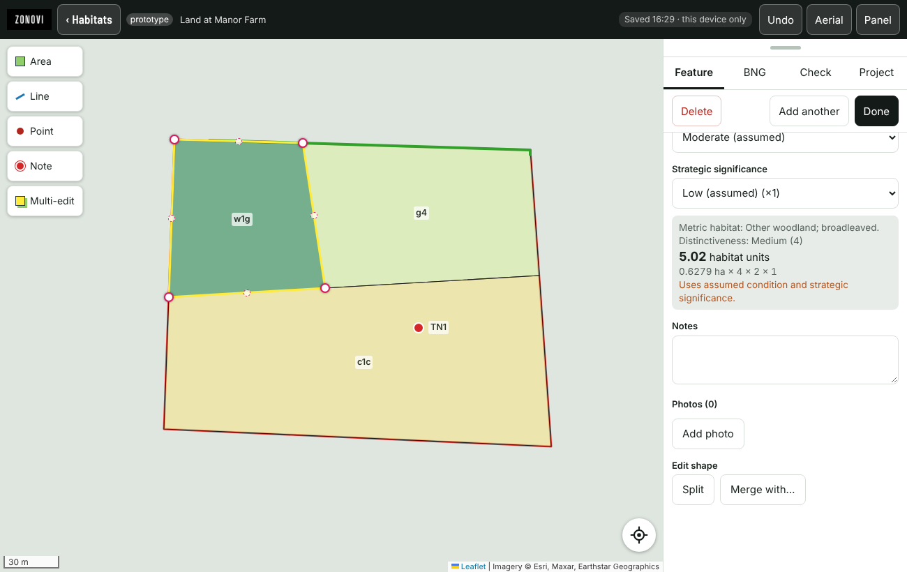
Most field apps cover habitats and stop there. ZEST carries the protected species work as well, so a site that needs a UKHab map, a badger walkover, two bat assessments and six breeding bird visits is one project, not five apps and a pile of spreadsheets.
Need a survey type that is not here? Tell us. New forms are built to the published guidance and added for everyone.
Everything is recorded on the device first, so a dead signal in the middle of a field changes nothing. Records sync to your cloud database a few seconds after each change once you are back in range.
A project holds the site boundary and every survey done on that site. Draw or import the red line once and it appears in all of them, from UKHab to the seventh wintering bird visit.
Trace follows a neighbouring habitat or the site boundary so edges stay coincident. Fill covers the unmapped remainder, split and merge reshape it, clip trims to the boundary, and slivers are absorbed instead of left behind.
Distinctiveness comes from the habitat code; condition and strategic significance default to a clearly labelled assumed value until an ecologist confirms them. Unit totals update as you draw.
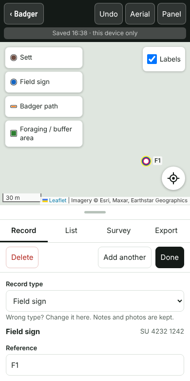
Badger, bat, GCN, reptile, invasive species and ECoW forms, plus breeding and wintering bird visits with BTO codes, BoCC status colouring and flight lines drawn from a cardinal direction.
Photographs attach to the record they belong to, target notes are their own numbered layer, and every record carries an OSGB grid reference.
Export GeoPackage with layer styles already applied, or GeoJSON and KML. QGIS can also read the live database directly, so the office sees field records as they arrive.
A4 PDF reports in your own branding: survey details, map figure, results tables, record schedules and photo plates.
Organisation accounts let you invite colleagues, share every project in the organisation, and keep each client’s data separate from everyone else’s.
The gap between the notebook and the GIS is where days disappear and errors creep in. ZEST closes it.
£25 per user per month, or £250 a year. Individuals and businesses pay the same; businesses just get an organisation that colleagues can join.